The EBN: Montréal's Express Bike Network
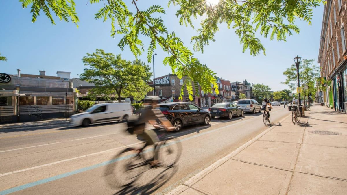
The Express Bike Network (EBN) is a 191 kilometre bike lane project that connects different points of interest in Montréal. With protected bike lanes, cyclists can travel by bike in a safe, efficient and pleasant way. Once the EBN is complete, it will have 17 routes accessible all year long.
Benefits for all Montrealers
The EBN clearly delineates the space reserved for each method of transportation, whether you are travelling on foot, by bike, by bus or by car. It has many advantages, not only for cyclists but also for the entire population:
- Making bike travel safer
- More equitable street sharing between methods of transportation
- Mitigation of car traffic
- Improved access to downtown and points of interest
- Vitalizing commercial streets and neighbourhood life
- Reduction in greenhouse gas emissions
Characteristics of the EBN
- Bike paths that are separated from car traffic and accessible all year long to cyclists of all skill levels
- High capacity lanes that are wide enough for cyclists to pass one another
- Paths that are designed to create the most direct routes for long distance trips
- Connection to existing bike lanes

Routes in progress
Avenue Viger/Rue Saint-Antoine/Rue Saint-Jacques
Once it is complete, this 5.4 kilometre route will cross Le Sud-Ouest and Ville-Marie from Rue De Courcelle to Rue Berri and connect downtown points of interest, such as the Quartier des spectacles, Old Montréal, the École de technologie supérieure, the Bell Centre and Atwater Market.
Boulevard Henri-Bourassa route
The EBN, which is part of the Boulevard Henri-Bourassa mobility corridor, will connect the boroughs of Saint-Laurent and Montréal-Nord. On some parts of the boulevard, express bus service will be provided. Parts of the route have been fully completed or are currently being completed.
Civic participation initiatives are planned for the various sections of the route.
Existing routes
Rue Berri/Rue Lajeunesse/Rue Saint-Denis axis (Piste Robert Silverman)
The Rue Berri/Rue Lajeunesse/Rue Saint-Denis axis crosses the island from north to south. This bike route was renamed in honour of cycling activist Robert Silverman. This key route has approximately 9 kilometers of bike paths. Between Boulevard Gouin and Rue Cherrier, Piste Robert Silverman crosses four boroughs and connects many important locations, such as the commercial street Rue Saint-Denis, the Sauvé intermodal station, Marché Jean-Talon and the Marc-Favreau and Plateau municipal libraries.
Avenue Souligny

The Avenue Souligny route extends from Rue Honoré-Beaugrand to Avenue Hector in Mercier–Hochelaga-Maisonneuve. It offers access to the Maison de la culture Mercier, the École secondaire Édouard-Montpetit and the Aréna Clément-Jetté. It consists of a 2.1 kilometre bi-directional bike path.
Rue Peel
From Boulevard René-Lévesque to Rue Smith, this route crosses downtown Montréal through the Quartier des gares and the Griffintown sector. Many points of interest are found along this route, including McGill and Concordia Universities, the École de technologie supérieure, the Bell Centre, Rue Sainte-Catherine Street, the Peel Basin and a few metro and light rail network stations. Eventually, the 1.7 kilometre route will extend to Boulevard De Maisonneuve.

Rue De Bellechasse

From Avenue de Gaspé to Rue Chatelain, this six kilometre route connects many institutions, including the Bibliothèque Marc-Favreau, Bibliothèque La Petite-Patrie and Bibliothèque Rosemont municipal libraries, the Collège de Rosemont, the Montréal Heart Institute, and two hospitals, the Hôpital Maisonneuve-Rosemont and the Hôpital Santa Cabrini. For more information on bike lane projects in Rosemont La-Petite-Patrie, visit the Vision Vélo Web page (in French).
Rue Notre-Dame/Parc de la Traversée

From Rue De Courcelle to Rue Berri, this 5.4 km route will cross Le Sud-Ouest and Ville-Marie, connecting downtown landmarks such as the Quartier des spectacles, Old Montréal, the École de technologie supérieure, the Bell Centre and the Atwater market.
Jean-Talon/Bélanger
The first section to the east was completed in 2024 and 2025 on Rue Jean-Talon, between Rue Boyer and 1re Avenue. To the west, the bike line was extended on Rue Bélanger.
In the long terme, the Rue Jean-Talon-Rue/Bélanger hub will stretch from east to west across 15 kilometres between Boulevard des Galeries d’Anjou and the future Namur-Hippodrome neighbourhood. It will link several hospitals, shops and public transportation stations as well as highways and railroads.
Civic participation
Would you like to know more about EBN projects and express your views about how they are developed? Check out the civic participation activities currently in progress ont the Réalisons Montréal Website.
Need help?
Contact us if you have questions.